Why Interactive Cartography?
RUKA is not just a digital project — it’s a methodology. A way to see the city differently, and to think about space, memory, and transformation through visual and spatial tools.
Sometimes, the simple act of placing knowledge on a map can do more than pages of text — revealing patterns, meanings, or relationships we couldn’t otherwise see. Visualizing urban data often leads to insights that written analysis alone cannot offer.
RUKA is our attempt to test what mapping can do today — and this is just the beginning.
We are launching the project with one district — Kala, the oldest part of Tbilisi — as a pilot. Our goal is to gradually expand this platform to other neighborhoods across Tbilisi, to build a growing, open-access, research-driven map of the city’s evolving layers, combining visual clarity with curatorial approach.
To start shaping our method, we turned to two key case studies that we believe represent some of the most meaningful mapping efforts in the city. We’ll tell you about both of them in the upcoming stories.
Tool 1: Looking Through Time — Comparing Maps Across Time
Cities are built layer upon layer — through demolitions, reconstructions, interventions, and accidents. Sometimes new structures erase what was there before, and sometimes they build upon it, leaving traces of the past in hidden alignments and invisible lines. To walk through a city is to move through a palimpsest, a space where centuries coexist under the surface.
One of the most powerful ways to understand this is through map comparison — laying one map over another to see how a place has evolved, how streets have shifted, how rivers have been redirected, where things were erased and where they stubbornly remained. In the past, this process meant relying on memory and visual approximation, a kind of intuitive detective work. But today, with digital tools, we can do this in a much more precise and interactive way.
We’ve been developing a custom interface that allows users to compare historical and contemporary maps of the same place — not just visually, but geometrically aligned for accuracy. Because old maps were created using different cartographic systems and projections, the first crucial step is to georeference and geometrically adapt them to match today’s coordinate systems. This lets us compare like with like — to trace the exact spot where an old path once cut through, or where a building once stood.
Once aligned, our tool offers a split-screen interface that synchronizes navigation between the two maps. As you zoom into a location or pan across a street on the modern map, the historical map moves with you — revealing the same place as it once was. This linked navigation transforms the comparison into a visceral experience.
For anyone interested — from curious residents to researchers, architects and planners — this tool becomes a gateway — a way to see how time shapes space, and how the past continues to inform the present. Our aim is to allow users to select different time periods, browse different historical maps, and instantly compare how a specific place looked — in the 1830s, the 1880s, the 1920s, or the 1970s — in relation to how it exists today.
Tbilisi is fortunate to have a large number of fascinating historical maps, most of them from the post-18th century period. Many of these were published in illustrated atlases and are available in digital archives or through urban historians who have them scanned in high resolution.
While we plan to further include many of these classic and widely known maps in the RUKA platform, for our first step we chose something different — something rarely seen, yet profoundly revealing: the police district cadastral maps, known as plansheti. These are large-scale cadastral sheets from the 19th century [exact date and title], created for administrative and policing purposes. They contain parcel-level detail — plot numbers, boundaries, and urban structure — and are stored in the National Archives of Georgia, previously unavailable to the public in digital form.
We chose to start here because, according to many urban scholars — including Levan Kalandarishvili, who taught a university course using these materials — these cadastral plans are the most geometrically accurate representations of Tbilisi’s 19th-century urban fabric. They depict the city not in symbolic or aesthetic terms, but with precise spatial fidelity, making them an invaluable source for analyzing urban transformation.
Thanks to a collaboration with the National Archives, we were able to obtain high-resolution scans of these rare materials. We’re deeply grateful for their cooperation.
This allowed us to overlay the [1837] cadastral grid onto the present-day map of Kala — and what emerges is extraordinary. Anyone visiting our website can now see the parcel geometry of 19th-century Tbilisi directly aligned with contemporary structures, revealing how much has changed — and how much still follows the lines of the past.
The moment we overlay the [1837] cadastral map onto contemporary Kala, a number of patterns immediately stand out. Much of the district’s street structure remains intact. This part of the city still follows the patterns etched into its fabric centuries ago. At the same time, we notice signs of transformation — the broadening of Kote Abkhazi (former Leselidze) Street in the Soviet era, the broadening of few squares, the construction of public buildings that replaced dense parcels.
Why were some alignments preserved? Why did others shift? As more users engage with the tool, they will spot their own anomalies, patterns, and questions. That’s the strength of a visual, interactive medium: it invites not only observation, but insight, hypothesis, and investigation. An unusual alignment between a modern courtyard and a long-vanished alley, a grid that fractures and reassembles around a new building, a subtle mismatch between cadastral lines and street curves. Each of these can become the starting point for a deeper inquiry. This tool is not just about looking — it’s about thinking through looking.
It encourages users to form intuitive theories based on what they see, and then to test those assumptions — through historical research, architectural analysis, or simply by walking the street and seeing what remains.

Tool 2: Rethinking Heritage — The Monument Map
The second feature of RUKA is the Monument Map — one that doesn’t just show buildings, but asks questions about how and why we value them. It gives a start to growing archive of 3D-modeled buildings selected not only for their official status, but for their urban presence, architectural quality, and cultural significance.
In 2023, we launched an open call for architecture students to join an internship program at Ubani. Their task was to research and model buildings that shape Tbilisi’s identity. Some were obvious landmarks. Others were quiet structures overlooked in the flow of daily life. The goal was not simply to digitize the city’s landmarks, but to spark a larger public conversation about the architecture around us. What do we consider valuable? Why do some buildings receive protection while others vanish unrecorded? Can a monument be unofficial, invisible, or emotional? With this in mind, our goal was to expand the definition of “monument”, by building a visual platform that includes not only state-recognized heritage, but also buildings selected through lists provided by experts and scholars of the city, suggestions by local researchers and practitioners and our own curatorial selection, based on a set of values we’ve developed as a team. This isn’t about creating a definitive list — it’s about starting one. A living, evolving inventory that reflects the richness and diversity of Tbilisi’s architectural environment.
Each building we include is geolocated on the map, modeled in 3D, and accompanied by information about its history and design. These buildings range widely in period and style — and their selection is guided not by bureaucratic status, but by urban presence: their role in the story of the city. Our hope is that this Monument Map becomes a platform to rediscover and revalue the built environment around us — and to invite the public into a more active relationship with the city’s material history.
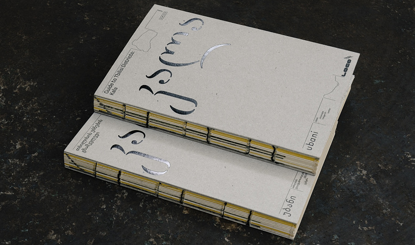
Since we are launching the RUKA project with Kala district as a pilot, the first collection of models is scattered across its area. The list of buildings was made by consolidation of three sources — the official state heritage registry; recommendations from respected scholars, including Maia Mania; lists from our team, including Nina Bughadze — Ubani researcher and author of our Kala guidebook text; the legacy of Vakhtang Tsintsadze, whose book on Tbilisi we are currently translating for release. All the buildings he surveyed within Kala have been added to the map. We also include lost buildings — structures that no longer exist but are mapped as part of the city’s [ghost layer]. These “absent monuments” are there to raise awareness and keep track of what is being lost, and why it matters.
Each building is geolocated, modeled in 3D, and presented with contextual data: photographs, historical background, archival references, and annotations. The Monument Map is not a static inventory — it’s a living structure. What we’ve built so far is just a starting point: an invitation to expand how we see and understand urban value.
Some of the most iconic monuments from the Kala district — selected through this process and reconstructed as 3D models — have already taken on a new life beyond the map. We’ve transformed them into a special collection of urban souvenirs, both digital and physical, designed to carry fragments of the city’s architectural memory into new contexts. You’ll hear more about this project soon.
Looking ahead, we’re planning to expand the Monument Map through thematic collections. These will include a modernist heritage list, collections based on specific time periods or typologies and additional waves of nominations through open calls and public input. Each object added to the map will come with its own information panel — including photographs, historical data, architectural details, and archival documentation where available. Over time, we envision the map as a kind of dynamic urban archive, constantly growing through research and contribution.
We also plan to use these lists as starting points for public discussions, expert roundtables, and collaborative explorations of what it means to preserve, interpret, and care for the architectural environment we live in.